I’ve tried tracing the skyline around my observing site to create the file using the website external app. I have been able to create the CSV file with the altitude and compass direction points. But I have not been successful in importing it in to TELESCOPIUS. I’ve tried reformatting the CSV a couple of different ways and trimming down some of the data but a simple cut and paste or the file isn’t working either. I did not find a YouTube video describing how this process works and I could use your help. I have been successful in creating my own sky Safari terrain mask. Is there a video tutorial around somewhere?
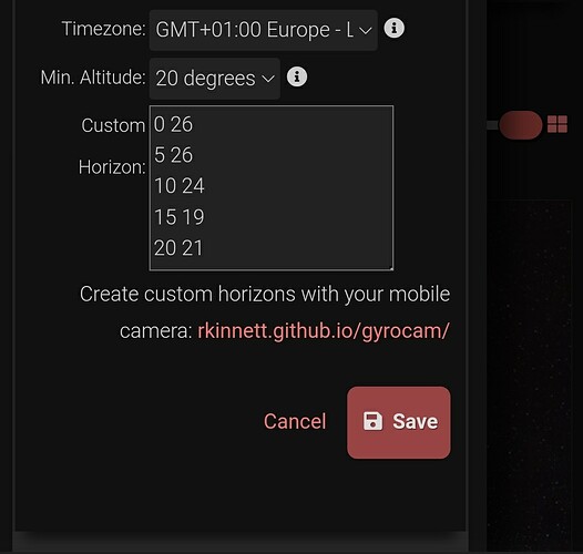
CSV is not supported. If you want to create it manually, what Vroobel said above works. This format is what’s used on other software like NINA and others, so we stick to that to increase interoperability.
The other alternative is to use the gyrocam link shown below the text box. That lets you use your phone camera to create that file while you pan your camera 360 degrees and select high points with your finger.
The example above shows two coordinates a new row and two more coordinates.
I don’t understand the syntax.
Thinking of my telescope site as a point in space it seems I would need a heading and a height.
The link to the simple app provides much more data. The next reply in this thread will show what I received.
| Heading | Az | El | Roll | gx | gy | gz |
|---|---|---|---|---|---|---|
| 234.7 | 45.45 | -2.68 | 181.05 | 0.02 | 9.75 | 0.38 |
| 285.3 | 97.88 | -2.84 | 180.52 | -0.17 | 9.81 | 0.49 |
| 1.7 | 171.78 | -0.81 | 181.62 | -0.2 | 9.79 | 0.01 |
| 29.2 | 201.21 | -0.83 | 180.99 | -0.2 | 9.73 | 0.08 |
| 41.9 | 218.99 | -1.3 | 181.51 | -0.25 | 9.79 | 0.19 |
| 76.8 | 247.89 | -1.08 | 182.01 | -0.34 | 9.77 | 0.18 |
| 89.1 | 272.12 | -1.58 | 181.68 | -0.14 | 9.8 | 0.42 |
| 121.6 | 294.95 | -1 | 180.65 | -0.25 | 9.84 | 0.31 |
| 109.4 | 286.88 | -1.84 | 179.82 | -0.03 | 9.76 | 0.3 |
| 161.2 | 331 | -4 | 181.1 | -0.25 | 9.78 | 0.8 |
| 227.7 | 36.41 | -5.67 | 182.89 | -0.52 | 9.78 | 0.84 |
Is this little applet pulling more information from my phone than I need? I’m guessing that I only need the first two columns? If not any additional comments you can provide will be appreciated comments that you can provide will be appreciated.
I’m not sure how you got that extended list, I’ve just tried the rkinnet.github.io/gyrocam app on my phone and I got a list that looks like this:
205, 10
255, 28
etc.
Please note you need to remove the commas for Telescopius. I should probably just strip the commas when you enter that info, I’ll do that in the future.
The first column contains Az, the second Alt. That defines your local horizon by telling Telescopius that at AZ 205 degrees, you have something (a tree, for example) blocking the view up to 10 degrees above the horizon, then the local horizon rises up to 28 degrees at AZ 255 degs, and so on.
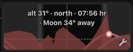
Telescopius will then draw lines from one point to the other. You can go as detailed as you want, and you’ll end up with something like this:

